- Navigation
- >
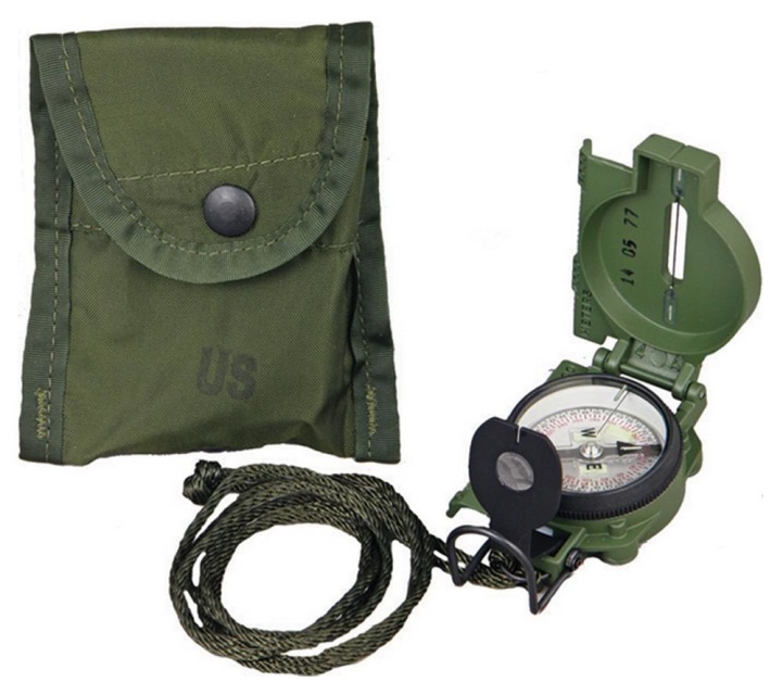
- Tritium Lensatic Compass Kit
Tritium Lensatic Compass Kit
Kit Features:
-Tritium Lensatic Compass
-Aluminum Frame and Waterproof Housing
-Bi-Directional Rotating Bezel
-Sapphire Jewel Bearing
-Seven Tritium Mirco Lights
Allowing Navigation in low light enviorments and conditions without the need for a flashlight or any light source
-Shock, Water, and Sand Proof and Functional Form
-50F to +150F Accuracy:+/- 0002 mils.
-Magnifying Glass Lens
-Sight Wire
-Dial Graduations In Both Degrees and Mils to Ensure Accurate Readings
-Copper Induction Damping System Slows The Rotation Of The Magnet Without The Use Of Liquids.
-OD Green Lanyard/Carrying Pouch
-LC-1 With Belt Clip
-Includes A Tear Proof Instruction Card
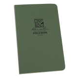
-Rite in the Rain
Stapled Notebook (3 Pack)
4'' 5/8 by 7''
-Flex Cover 12 sheets
-Sheds water and enables you to write in all weather
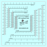
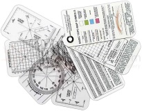
-Esee Navigation Help Cards
This plastic card set is a must-have for anyone using GPS, map and compass. The set features 3 clear cards with 1:24,000, 1:25,000, 1:50,000, 1:100,000, and 1:250,000 map scales. The set also includes two white cards with survival tips, signaling tips, instructions on how to read a topo map, how to adjust for declination, how to determine distance traveled, how to use UTM with your GPS and compass, and how to travel an azimuth. Printed on 30 Mil plastic credit card stock. Made in the USA.
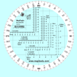
-Two Navigation Protractor
- The tool is printed on plastic stock with a protective coating.
- This makes it about the thickness and stiffness of a credit card. It’s 33% thicker than the standard military issue version, so it’s less likely to bent or broken when you need to use it.
- Rounded corners keep it from wearing holes in your pockets.
- Includes 1:24,000 scale for USGS 7.5 minute topographic maps.
- Larger 1:50,000 and 1:100,000 scale rulers for maps with wider grid spacing.
- Larger print type on both the scales and compass rose.
- It's the size of a music CD, so it tucks away in more storage spaces.
This tool combines 14 of the most common topographic map scales into a single tool about the size of a CD. The slot style tool gives easy access to the map for marking, while maintaining superior accuracy.
Scales:
- 1:10,000 x 1km†
- 1:15,000 x 1km
- 1:20,000 x 1km
- 1:24,000 x 1km
- 1:25,000 x 1km
- 1:30,000 x 1km
- 1:62,500 x 5km
- 1:100,000 x 10km
- 1:125,000 x 10km
- 1:150,000 x 10km†
- 1:200,000 x 10km†
- 1:250,000 x 10km†
- 1:300,000 x 10km†
- 1:1,000,000 x 100km
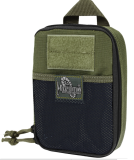
-Carry Bag
OD Green. Compact 5" x 7" x 2" size. Drops into or attaches onto backpack or bag. Full clamshell opening main compartment with dual zippers. Inside left: Slip pocket; key ring; tie-down loop, elastic organizer with 9 divisions. Inside right: zipper pocket; elastic organizer with 6 divisions. Inside center has additional elastic loop. Front exterior: 2" x 3" loop field for patches; mesh slip pocket with hook-and-loop closure. Back exterior: Oversized carry handle; attachment webbing. MOLLE compatible. Can be attached using two 3" TackTie Attachment Straps (sold separately). nylon thread (stronger than ordinary industry standard nylon thread). #AS-100 high grade closed-cell foam padding material for superior shock protection. High tensile strength nylon webbing. #10 high strength zippers and zipper tracks. UTX-Duraflex nylon buckles for low sound closures.
